I created this “interactive map” of Death Valley National Park shortly after my husband and I visited the park in 2021. My inspiration first came from my frustration when researching and planning for our trip. The information available on the internet was very segmented and it was difficult to string everything I jotted down together when planning the trip. This motivated me to build something more informative and user-friendly for all the potential Death Valley NP visitors out there!
Here were a couple pain points I focused on when building my map:
1. We wanted to string multiple spots together and minimize driving.
For those that haven’t been, Death Valley is a HUGE national park. In fact, it is the largest National Park in the continental United States. Which means, it can take hours to drive from one landmark to another. When I was making notes of hikes and viewpoints I wanted to visit, the majority of the websites/blogs/videos out there listed each spot as its own entity and there was very little information how we should plan our trip to do minimal driving and maximize our time.
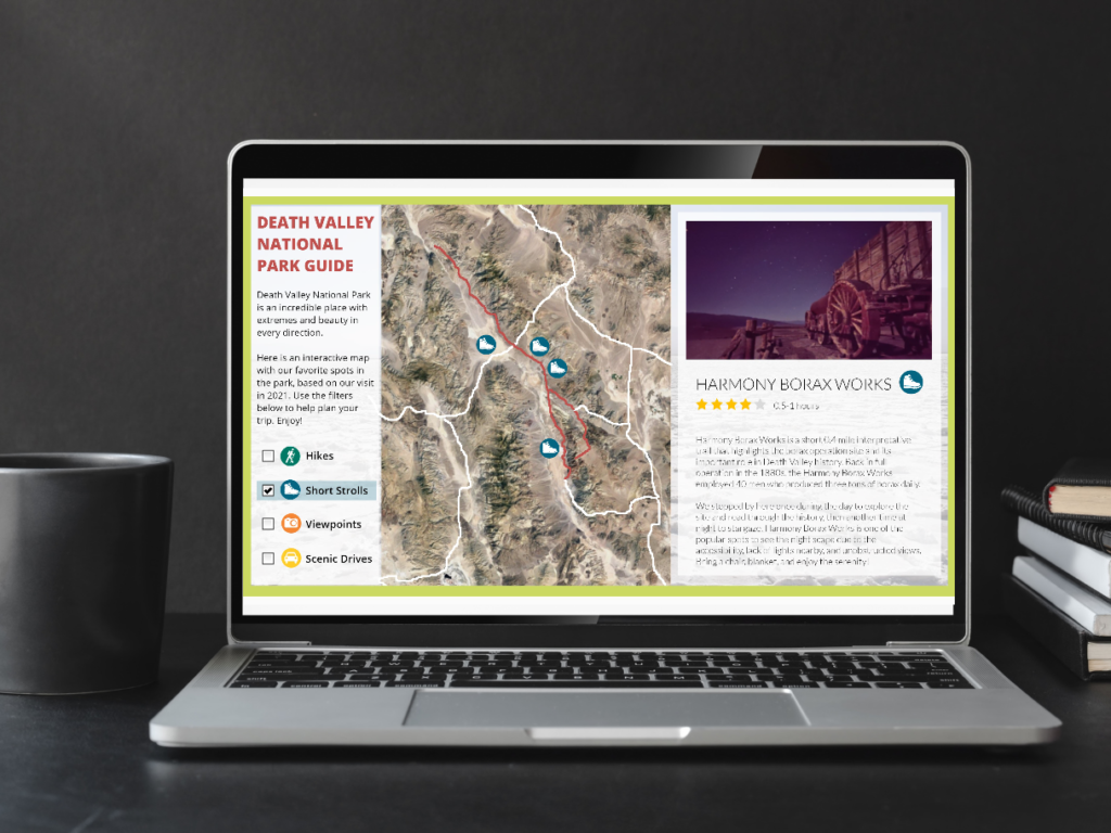
Hence, when creating my “guide” after our visit I made it a point to present the content as an interactive map. This gives people another layer of information – not just about the points of interest, but where they are located and what other spots are nearby. This way, it is much easier to string this information together and build a functional itinerary.

2. We wanted to mix up our day with a variety of activities.
Although we didn’t visit during the peak of summer, it was already pretty hot. We wanted to break up our day with a variety of activities so we didn’t end up doing all the strenuous hiking/walking in 1 day and spend the next day mostly in the car. We found the best balance for us was to do 1-2 hikes per day, combined with shorter strolls, view points, and scenic drives.
The interactive map I built makes it easy to dissect this information using the checkbox filters I created that hide and show the buttons based on the type of spot – Hikes, Short Strolls, View Points, and Scenic Drives.

Once we returned from our visit, I decided immediately to build this interactive map on Articulate Storyline to provide information for future Death Valley visitors, showcase my Storyline work on my portfolio, and document our awesome trip in a fun way!
To see the full interactive map, click here the link below:
https://sysharonlo.s3.amazonaws.com/deathvalley/story.html
Enjoy nature!
Best,
Sharon